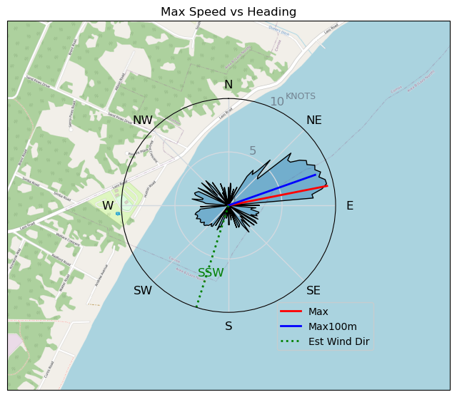
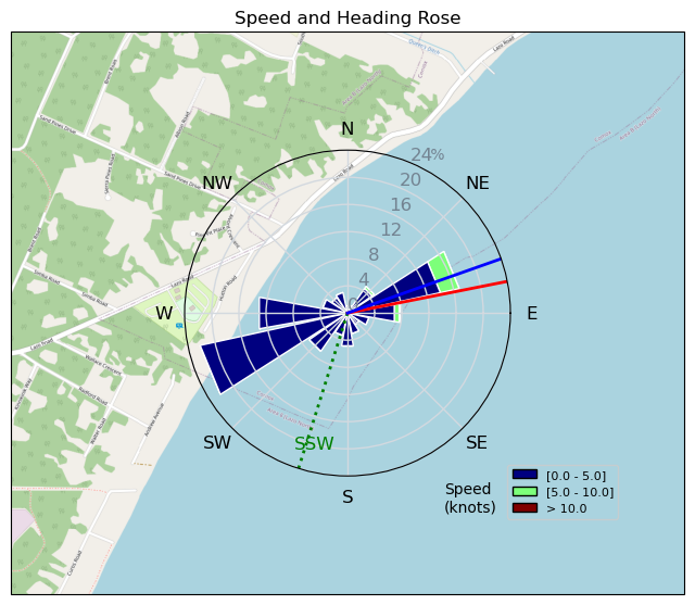
Pt.Holmes 03/25
mayday - Wingfoiling |
Monday March 25, 2024 4:37 PM |
| Spot | Comox Spit |
| Conditions | SE 10-12, chop |
| TOW | 0.5 hours |
| Toys | 1880 reedin flight attendant |
| 6m duotone slick | |
| 115 quattro drifter | |
| Details | Well, THAT didn't go according to plan:-( I only logged it to illustrate several don'ts. Don't ignore the anemometer saying there is barely enough. Don't ignore your gut saying there really isn't enough. Even if you do get up on foil, don't continue to pump out farther and farther. Tried to drift in on the dying puffs, but finally had to admit defeat and start paddling . In my defense, apparently I am an addict, and was going through wing withdrawal. [from Session Log on Monday March 25, 2024] |
Speed (3s average)
| Speed | knots | km/h |
|---|---|---|
| Avg overall | 1.8 | 3.4 |
| Avg in motion | 3.3 | 6.2 |
| Max | 9.4 | 17.4 |
| Max 100m | 8.4 | 15.6 |
| Max 250m | 7.9 | 14.7 |
| Max 500m | 6.2 | 11.5 |
| Max 2s | 9.4 | 17.3 |
| Max 10s | 8.9 | 16.5 |
| Max Alpha (500/50m) | 0.0 | 0.0 |
| Avg Foiling | 7.6 | 14.0 |
Times and Duration
| Start | Mon Mar 25, 4:37 PM |
| End | Mon Mar 25, 5:22 PM |
| Duration | 00:45:13 |
| In motion | 00:24:40 |
| Paused (< 3 km/h) | 00:19:14 |
| Foiling | 00:01:50 |
| Not Foiling (< 8 km/h) | 00:42:04 |
| Longest Foiling Segment | 00:01:50 (429 m) |
| Last Calculated | Mon Mar 25, 5:50 PM |
Track Information
| Distance | 2.5 km |
| # Trackpoints | 2713 |
| Avg Trackpoint distance | 0.9 m |
| Number of Turns | 16 |
| Foiling Turns (> 8 km/h) | 0 |
| Foiling Turn Percentage | 0% |


Category: Wingfoiling
9 months ago

Created 9 months ago
mayday |
Please register/login to download this track.
This track was downloaded 0 time(s). |
| 33 241124 Willows |
| 36 WillowsQuickie |
| 32 Willows - Sunday Funday Woops |
| 30 Willows Mixed Bag |
| 25 Surprise Sunday ENE. |
Please wait while loading suggestions..
Please wait while loading suggestions..
You must login to post comments.