RB - First Wing Sesh
Bobson - Wingfoiling |
Tuesday March 26, 2024 12:52 PM |
| Spot | Ross Bay |
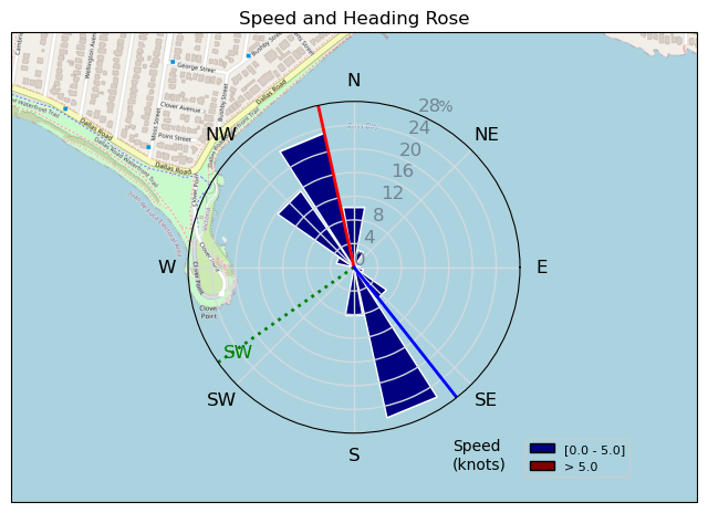
| Conditions | SW 8-13, bumpy |
| TOW | 2.3 hours |
| Toys | 255 Starboard Stabilizer |
| 85cm Starboard Mast | |
| 1100 Starboard Evolution Foil | |
| 115 Starboard Evolution Fuse | |
| 6.2 Ensis Score | |
| 150 Starboard Freeride | |
| Details | Well, that kinda sucked! This Wing Whatever isn't as much fun as everyone says it is. HA!! I got going quick enough once, near the end but just not enough wind or 'Wing-skill' to get flying. Probably a bit to do with my smallish (1100cm2) front foil and my weak 'Wing-skill'. I feel that if there was 15kts, I could have been flying and crashing. It was a good day to learn how to hold and pump the Wing. It will take more practice but it was a pretty good first day even though I didn't really get flying. Lots of friendly faces out there motivating me to keep 'trying'. Can't wait to try again. A cold beverage on the beach post-session made the negative feelings coming from not flying much better. Now, at home, an ice-cold Corona is making me feel much better! WINGSON OUT!! [from Session Log on Tuesday March 26, 2024] |
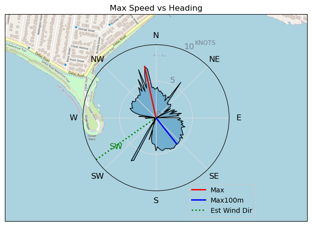
Speed (3s average)
| Speed | knots | km/h |
|---|---|---|
| Avg overall | 2.9 | 5.3 |
| Avg in motion | 3.0 | 5.6 |
| Max | 7.2 | 13.3 |
| Max 100m | 4.0 | 7.5 |
| Max 250m | 3.8 | 7.1 |
| Max 500m | 3.7 | 6.8 |
| Max 2s | 7.1 | 13.2 |
| Max 10s | 6.1 | 11.3 |
| Max Alpha (500/50m) | 3.4 | 6.3 |
| Avg Foiling | 4.9 | 9.1 |
Times and Duration
| Start | Tue Mar 26, 12:52 PM |
| End | Tue Mar 26, 3:11 PM |
| Duration | 02:18:36 |
| In motion | 02:10:23 |
| Paused (< 3 km/h) | 00:06:30 |
| Foiling | 00:01:26 |
| Not Foiling (< 8 km/h) | 02:15:27 |
| Longest Foiling Segment | 00:00:13 (31 m) |
| Last Calculated | Tue Mar 26, 5:08 PM |
Track Information
| Distance | 12.2 km |
| # Trackpoints | 8316 |
| Avg Trackpoint distance | 1.5 m |
| Number of Turns | 30 |
| Foiling Turns (> 8 km/h) | 0 |
| Foiling Turn Percentage | 0% |


Category: Wingfoiling
8 months ago

Created 8 months ago
Bobson |
Please register/login to download this track.
This track was downloaded 0 time(s). |
| 33 241124 Willows |
| 36 WillowsQuickie |
| 32 Willows - Sunday Funday Woops |
| 30 Willows Mixed Bag |
| 25 Surprise Sunday ENE. |
Please wait while loading suggestions..
Please wait while loading suggestions..
You must login to post comments.