1st Nitinat Day 2024 (attempt 3)
slake - Wingfoiling |
Friday May 10, 2024 1:49 PM |
| Spot | Nitinat Lk |
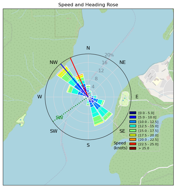
| Conditions | SW 15-20, 1-2' |
| TOW | 3.5 hours |
| Toys | Armstrong HA925 |
| 4m Nexen | |
| 5'5" 88L Armstrong Wing SUP | |
| Details | So foggy to try to remember 3 days back (should have taken notes). First day at Nitinat 2024. Decided to go with Ms. Slaker when the weather looked good. In fact it was her who said Thursday - hey it is sunny and warm in Alberni, and colder in Bamfield, let's go to Nitinat (wow!). Only a handful of folks around. My neighbour was Pepe Krause and it is amazing to see what these young folks can do wing foiling. To boot he and his family are super nice, and he was super open to talk foiling/gear/setup - very cool. Worked mostly on heel side tacks and following the Ms. around a bit on the water. [from Session Log on Friday May 10, 2024] |
Speed (3s average)
| Speed | knots | km/h |
|---|---|---|
| Avg overall | 8.4 | 15.6 |
| Avg in motion | 11.6 | 21.5 |
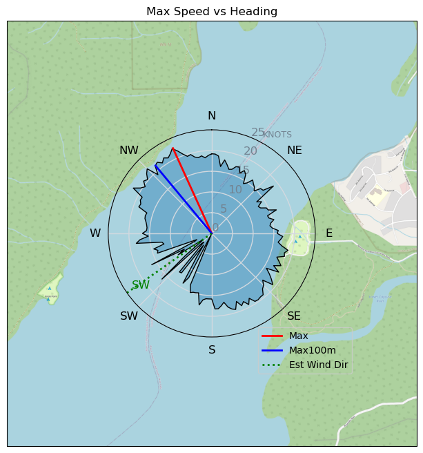
| Max | 22.6 | 41.8 |
| Max 100m | 21.2 | 39.3 |
| Max 250m | 20.6 | 38.1 |
| Max 500m | 18.5 | 34.3 |
| Max 2s | 22.6 | 41.8 |
| Max 10s | 21.2 | 39.3 |
| Max Alpha (500/50m) | 16.7 | 30.8 |
| Avg Foiling | 13.2 | 24.5 |
Times and Duration
| Start | Fri May 10, 1:49 PM |
| End | Fri May 10, 6:23 PM |
| Duration | 04:33:04 |
| In motion | 03:18:04 |
| Paused (< 3 km/h) | 01:14:29 |
| Foiling | 02:45:34 |
| Not Foiling (< 8 km/h) | 01:46:59 |
| Longest Foiling Segment | 00:21:44 (10.2 km) |
| Last Calculated | Sun May 12, 11:32 PM |
Track Information
| Distance | 71.0 km |
| # Trackpoints | 6313 |
| Avg Trackpoint distance | 11.2 m |
| Number of Turns | 161 |
| Foiling Turns (> 8 km/h) | 121 |
| Foiling Turn Percentage | 75% |


Category: Wingfoiling
7 months ago

Created 7 months ago
slake |
Please register/login to download this track.
This track was downloaded 0 time(s). |
| 20 241124 Willows |
| 24 WillowsQuickie |
| 21 Willows - Sunday Funday Woops |
| 24 Willows Mixed Bag |
| 19 Surprise Sunday ENE. |
Please wait while loading suggestions..
Please wait while loading suggestions..
You must login to post comments.