20240513
ThePope - Wingfoiling |
Monday May 13, 2024 12:52 PM |
| Spot | Ross Bay |
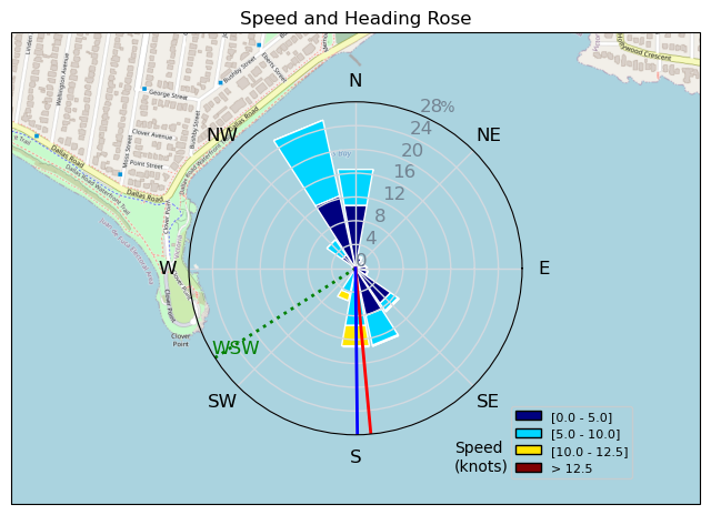
| Conditions | SW 12-20, 1m |
| TOW | 1.8 hours |
| Toys | Armstrong CF300V2 |
| 70 Armstrong Fuse | |
| 1850 Armstrong HS | |
| 865 Armstrong Performance | |
| 5.5m Duotone Unit | |
| 99L Armstrong FG Wing SUP | |
| Details | Launched just as MtnarG was coming in -- timed it perfectly so that the wind dropped to almost nothing as I stepped into the water. By the time I finally got out to the wind line I had drifted further downwind than I liked. The wind came up enough so that I was finally able to get on foil and then managed to fight my way back upwind. Feeling better on my bad side and starting to get on foil easier. Now focused on foot switches, progressing from wipe-out-swim-gybes to stay-on-the-board gybes, and toeside riding. No more walks of shame! Some fun passes in the deep end with Danno, Gus, Ang and Grant. Great day! [from Session Log on Monday May 13, 2024] |
Speed (3s average)
| Speed | knots | km/h |
|---|---|---|
| Avg overall | 2.9 | 5.3 |
| Avg in motion | 5.3 | 9.8 |
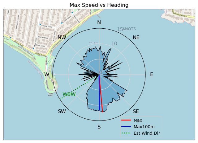
| Max | 12.2 | 22.5 |
| Max 100m | 11.7 | 21.6 |
| Max 250m | 11.3 | 20.8 |
| Max 500m | 10.5 | 19.4 |
| Max 2s | 12.1 | 22.4 |
| Max 10s | 11.8 | 21.8 |
| Max Alpha (500/50m) | 7.3 | 13.6 |
| Avg Foiling | 6.9 | 12.8 |
Times and Duration
| Start | Mon May 13, 12:52 PM |
| End | Mon May 13, 2:55 PM |
| Duration | 02:03:50 |
| In motion | 01:07:09 |
| Paused (< 3 km/h) | 00:56:37 |
| Foiling | 00:33:17 |
| Not Foiling (< 8 km/h) | 01:30:29 |
| Longest Foiling Segment | 00:02:18 (693 m) |
| Last Calculated | Mon May 13, 7:47 PM |
Track Information
| Distance | 11.0 km |
| # Trackpoints | 3349 |
| Avg Trackpoint distance | 3.3 m |
| Number of Turns | 14 |
| Foiling Turns (> 8 km/h) | 1 |
| Foiling Turn Percentage | 7% |


Category: Wingfoiling
7 months ago

Created 7 months ago
ThePope |
Please register/login to download this track.
This track was downloaded 0 time(s). |
| 14 RB - Nov 11 2024 |
| 19 RB - Nov 14 2024 |
| 29 Nov RB |
| 34 RB - Terminator Eyes |
| 26 Clover and a gnarly shoreline |
Please wait while loading suggestions..
Please wait while loading suggestions..
You must login to post comments.