Wildwildpatbay
AJSpencer - Wingfoiling |
Thursday May 16, 2024 4:06 PM |
| Spot | Pat Bay |
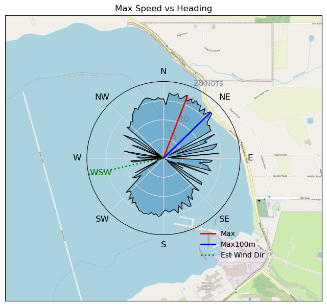
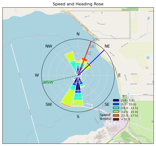
| Conditions | WNW 5-40, mixed |
| TOW | 1.5 hours |
| Toys | 300 Axis Rear Performance |
| 999 Axis Art | |
| 105 Axis Mast | |
| 4.0 Duotone Slick | |
| 5.0 Duotone Slick | |
| 105 Quatro Wing Drifter | |
| Details | Nasty one. More wobbly wind coming in close to NW mixed with W. Punchy. Not a good mix with still getting used to short fuse and 999. Sketchy bails. Looked and smelt like the coast guard was discharging their holding tank into the bay. Disgusting. A seal popped up with a stupid look on its face that said 'was that you or' was that me''?. 2m/~40knots on arrival. Went out with 4m a short while later, died down, went out with 5m then was op'd. Bad timing but good experience as always! Big wind here all day. [from Session Log on Thursday May 16, 2024] |
Speed (3s average)
| Speed | knots | km/h |
|---|---|---|
| Avg overall | 4.4 | 8.1 |
| Avg in motion | 8.5 | 15.8 |
| Max | 17.5 | 32.3 |
| Max 100m | 17.0 | 31.4 |
| Max 250m | 16.6 | 30.7 |
| Max 500m | 14.8 | 27.4 |
| Max 2s | 17.4 | 32.2 |
| Max 10s | 17.0 | 31.5 |
| Max Alpha (500/50m) | 9.8 | 18.1 |
| Avg Foiling | 11.7 | 21.7 |
Times and Duration
| Start | Thu May 16, 4:06 PM |
| End | Thu May 16, 5:51 PM |
| Duration | 01:44:52 |
| In motion | 00:53:43 |
| Paused (< 3 km/h) | 00:51:03 |
| Foiling | 00:31:40 |
| Not Foiling (< 8 km/h) | 01:13:06 |
| Longest Foiling Segment | 00:04:47 (2.0 km) |
| Last Calculated | Thu May 16, 6:41 PM |
Track Information
| Distance | 14.1 km |
| # Trackpoints | 2880 |
| Avg Trackpoint distance | 4.9 m |
| Number of Turns | 25 |
| Foiling Turns (> 8 km/h) | 2 |
| Foiling Turn Percentage | 8% |


Category: Wingfoiling
7 months ago

Created 7 months ago
AJSpencer |
Please register/login to download this track.
This track was downloaded 0 time(s). |
| 38 Swell beckons |
| 32 Clover week |
| 41 Double rainbowwww |
| 32 aCloverBalmyBombo |
| 28 Maytag day at IV 20241122 |
Please wait while loading suggestions..
Please wait while loading suggestions..
You must login to post comments.