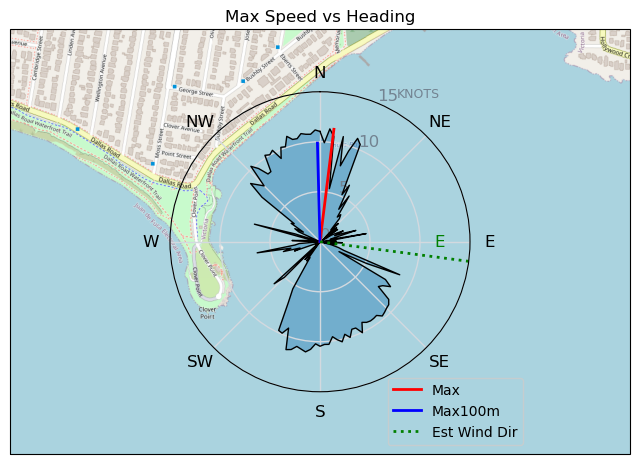
20240520
ThePope - Wingfoiling |
Monday May 20, 2024 5:03 PM |
| Spot | Ross Bay |
| Conditions | WSW 15-25, 1m-1.5m |
| TOW | 1.8 hours |
| Toys | Popemobile |
| 300V2 Armstrong CF | |
| 70 Armstrong Fuse | |
| 1850 Armstrong HS | |
| 4m Duotone Unit | |
| 5.5m Duotone Unit | |
| 99L Armstrong FG Wing SUP | |
| Details | I'm feeling a lot more controlled on foil on both sides, and getting better at staying low on the mast to minimize sketchy wipe outs. It's still a novelty to be able to steer in directions other than just as far upwind as I can go, so I had fun sailing on beam and broad reaches, and zipping over towards Ang, Jon, and Andrew to give them a whoop. I made my way out towards RupDogg a few times, who was flagged out in the big swells past Clover, and decided I might need to get a little better before I spend too much time in that neck of the woods. I finally made my first taxiing gybes today and practiced foot switches. I'm feeling like I can graduate to my MA 1475 pretty soon. Great session! [from Session Log on Monday May 20, 2024] |
Speed (3s average)
| Speed | knots | km/h |
|---|---|---|
| Avg overall | 3.5 | 6.6 |
| Avg in motion | 5.8 | 10.8 |
| Max | 11.3 | 21.0 |
| Max 100m | 10.5 | 19.4 |
| Max 250m | 9.8 | 18.1 |
| Max 500m | 9.3 | 17.1 |
| Max 2s | 11.3 | 20.9 |
| Max 10s | 10.8 | 19.9 |
| Max Alpha (500/50m) | 7.9 | 14.6 |
| Avg Foiling | 7.7 | 14.2 |
Times and Duration
| Start | Mon May 20, 5:03 PM |
| End | Mon May 20, 6:43 PM |
| Duration | 01:40:11 |
| In motion | 01:00:52 |
| Paused (< 3 km/h) | 00:38:33 |
| Foiling | 00:33:44 |
| Not Foiling (< 8 km/h) | 01:05:41 |
| Longest Foiling Segment | 00:02:44 (637 m) |
| Last Calculated | Mon May 20, 10:27 PM |
Track Information
| Distance | 10.9 km |
| # Trackpoints | 3058 |
| Avg Trackpoint distance | 3.6 m |
| Number of Turns | 13 |
| Foiling Turns (> 8 km/h) | 1 |
| Foiling Turn Percentage | 8% |


Category: Wingfoiling
7 months ago

Created 7 months ago
ThePope |
Please register/login to download this track.
This track was downloaded 0 time(s). |
| 38 Swell beckons |
| 31 Clover week |
| 41 Double rainbowwww |
| 32 aCloverBalmyBombo |
| 28 Maytag day at IV 20241122 |
Please wait while loading suggestions..
Please wait while loading suggestions..
You must login to post comments.