240526 Pipers Lagoon
Highrocker - Wingfoiling |
Sunday May 26, 2024 12:40 PM |
| Spot | Pipers Lgn |
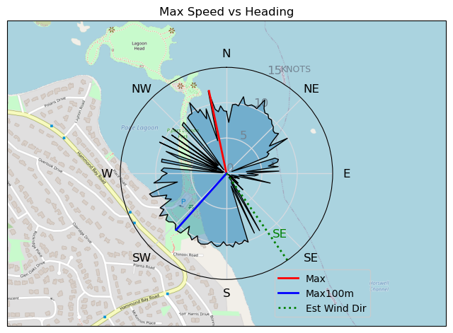
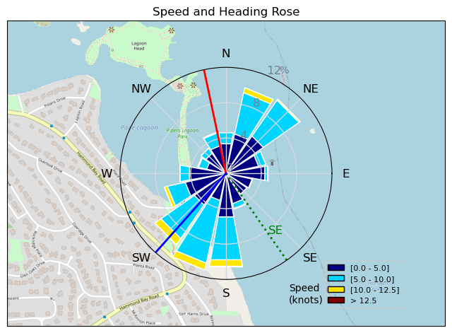
| Conditions | SE 12-18, chop to 2ft swell |
| TOW | 1.0 hours |
| Toys | 900mm Axis Aluminum Mast |
| 2050sqcm Axis 1020mm Carbon Front Wing | |
| 6m Cabrinha X3 Windows | |
| 4m Cabrinha X3 Windows | |
| 115L JP Australia Foil Pro | |
| Details | A family errand to Nanaimo served as the perfect excuse for a quick Pipers session. Lots of signs of big wind from the SE on the way up. But, I got fooled at the Pipers parking lot where it felt like a 4m. SE felt weird and weakish, gaining me just one foiling run. I switched to a 6m and all was well and even occasionally OP'd as the gusts beyond the light was pushing me around. I played near-shore to ease my foiling solo anxiety. Fun session. A winger came in as I was leaving with a fin thinking about joining in. [from Session Log on Sunday May 26, 2024] |
Speed (3s average)
| Speed | knots | km/h |
|---|---|---|
| Avg overall | 3.3 | 6.0 |
| Avg in motion | 6.2 | 11.5 |
| Max | 11.9 | 22.1 |
| Max 100m | 10.5 | 19.4 |
| Max 250m | 10.0 | 18.6 |
| Max 500m | 9.6 | 17.8 |
| Max 2s | 11.9 | 22.1 |
| Max 10s | 10.8 | 19.9 |
| Max Alpha (500/50m) | 9.2 | 17.0 |
| Avg Foiling | 8.2 | 15.2 |
Times and Duration
| Start | Sun May 26, 12:40 PM |
| End | Sun May 26, 2:11 PM |
| Duration | 01:30:34 |
| In motion | 00:47:28 |
| Paused (< 3 km/h) | 00:38:43 |
| Foiling | 00:27:32 |
| Not Foiling (< 8 km/h) | 00:58:39 |
| Longest Foiling Segment | 00:13:46 (3.7 km) |
| Last Calculated | Sun May 26, 9:44 PM |
Track Information
| Distance | 9.1 km |
| # Trackpoints | 1884 |
| Avg Trackpoint distance | 4.8 m |
| Number of Turns | 60 |
| Foiling Turns (> 8 km/h) | 33 |
| Foiling Turn Percentage | 55% |


Category: Wingfoiling
6 months ago

Created 6 months ago
Highrocker |
Please register/login to download this track.
This track was downloaded 0 time(s). |
| 40 Swell beckons |
| 36 Clover week |
| 42 Double rainbowwww |
| 32 aCloverBalmyBombo |
| 28 Maytag day at IV 20241122 |
Please wait while loading suggestions..
Please wait while loading suggestions..
You must login to post comments.