240601 Esquimalt Harbour
Highrocker - Wingfoiling |
Saturday June 01, 2024 3:37 PM |
| Spot | [Secret spot] |
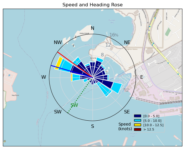
| Conditions | SW 6-12, chop to 1ft |
| TOW | 1.0 hours |
| Toys | 900mm Axis Aluminum Mast |
| 2050sqcm Axis 1020mm Carbon Front Wing | |
| 5m Cabrinha X3 Windows | |
| 115L JP Australia Foil Pro | |
| Details | Pretty poor OSRs from the usual venues, so I thought I'd try something a bit closer to home and try to buzz the Navy frigates that I used to serve on. Sadly, I picked 5 when I should have went 6. Onshore made it tough to get out. The loose and rooted kelp and unfamiliarity with the location increased the difficulty. Wind was light and not as carveable as I like it. Regardless, I've ticked that location and it's worth a return if the conditions are favourable. Cool to try new places! [from Session Log on Saturday June 01, 2024] |
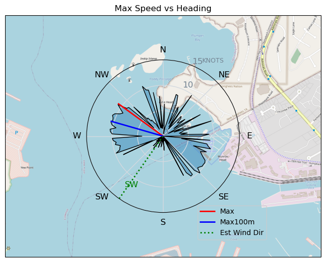
Speed (3s average)
| Speed | knots | km/h |
|---|---|---|
| Avg overall | 4.0 | 7.4 |
| Avg in motion | 4.9 | 9.1 |
| Max | 10.8 | 20.0 |
| Max 100m | 10.3 | 19.1 |
| Max 250m | 10.0 | 18.6 |
| Max 500m | 9.7 | 17.9 |
| Max 2s | 10.8 | 20.0 |
| Max 10s | 10.7 | 19.8 |
| Max Alpha (500/50m) | 9.0 | 16.7 |
| Avg Foiling | 8.2 | 15.2 |
Times and Duration
| Start | Sat Jun 01, 3:37 PM |
| End | Sat Jun 01, 4:27 PM |
| Duration | 00:50:32 |
| In motion | 00:41:19 |
| Paused (< 3 km/h) | 00:08:14 |
| Foiling | 00:14:30 |
| Not Foiling (< 8 km/h) | 00:35:03 |
| Longest Foiling Segment | 00:04:05 (1.0 km) |
| Last Calculated | Sat Jun 01, 11:00 PM |
Track Information
| Distance | 6.2 km |
| # Trackpoints | 822 |
| Avg Trackpoint distance | 7.6 m |
| Number of Turns | 20 |
| Foiling Turns (> 8 km/h) | 5 |
| Foiling Turn Percentage | 25% |


Category: Wingfoiling
6 months ago

Created 6 months ago
Highrocker |
Please register/login to download this track.
This track was downloaded 0 time(s). |
| 4 my PB highest jump at Clover |
| 15 RB - Nov 11 2024 |
| 21 RB - Nov 14 2024 |
| 30 Nov RB |
| 35 RB - Terminator Eyes |
Please wait while loading suggestions..
Please wait while loading suggestions..
You must login to post comments.