Upside Down Day
tugboat - Wingfoiling |
Sunday June 09, 2024 3:45 PM |
| Spot | Ross Bay |
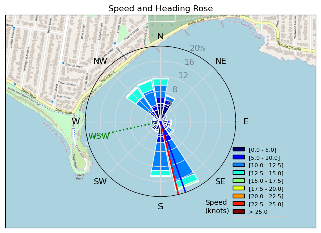
| Conditions | WSW 18-25, 2-5ft |
| TOW | 1.8 hours |
| Toys | Omen Ahi Large |
| 87 cm Omen The Stiffy | |
| 1050cm 2 Omen Operator 1050 | |
| 4m KT Wing Air DD | |
| 72L Omen Flux | |
| Details | Upside down day. I guess that is the way. Longest single period on a foil without dropping...20-30mins? It felt like forever. Consistent wind for first hour. Great day to link swells. Lots of others killing it too. Tough ending with a total wind drop and swim. That was my queue to appreciate what I received and head home for dinner. [from Session Log on Sunday June 09, 2024] |
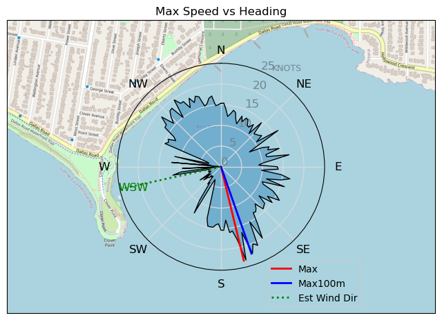
Speed (3s average)
| Speed | knots | km/h |
|---|---|---|
| Avg overall | 7.3 | 13.6 |
| Avg in motion | 9.8 | 18.1 |
| Max | 23.4 | 43.2 |
| Max 100m | 17.5 | 32.4 |
| Max 250m | 14.3 | 26.5 |
| Max 500m | 13.3 | 24.6 |
| Max 2s | 22.8 | 42.2 |
| Max 10s | 16.7 | 31.0 |
| Max Alpha (500/50m) | 12.8 | 23.7 |
| Avg Foiling | 11.6 | 21.6 |
Times and Duration
| Start | Sun Jun 09, 3:45 PM |
| End | Sun Jun 09, 5:29 PM |
| Duration | 01:44:28 |
| In motion | 01:18:01 |
| Paused (< 3 km/h) | 00:22:03 |
| Foiling | 00:57:24 |
| Not Foiling (< 8 km/h) | 00:42:40 |
| Longest Foiling Segment | 00:17:10 (6.4 km) |
| Last Calculated | Sun Jun 09, 7:49 PM |
Track Information
| Distance | 23.6 km |
| # Trackpoints | 5571 |
| Avg Trackpoint distance | 4.2 m |
| Number of Turns | 131 |
| Foiling Turns (> 8 km/h) | 75 |
| Foiling Turn Percentage | 57% |


Category: Wingfoiling
6 months ago

Created 6 months ago
tugboat |
Please register/login to download this track.
This track was downloaded 0 time(s). |
| 15 RB - Nov 11 2024 |
| 21 RB - Nov 14 2024 |
| 30 Nov RB |
| 34 RB - Terminator Eyes |
| 26 Clover and a gnarly shoreline |
Please wait while loading suggestions..
Please wait while loading suggestions..
You must login to post comments.