CC - June 23 - Day 2 - Windfoil
Bobson - Windfoiling |
Sunday June 23, 2024 11:11 AM |
| Spot | China Ck |
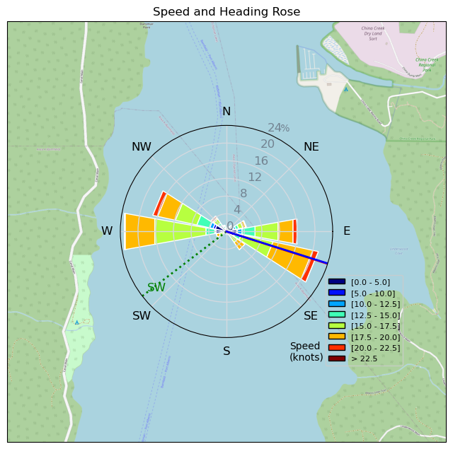
| Conditions | W 12-20, Flat |
| TOW | 3.8 hours |
| Toys | 85cm Starboard Mast |
| 115 Starboard Evolution Fuse | |
| 900 Starboard Evolution Foil | |
| 255 SLR Starboard Stabilizer | |
| 5.2 Sailworks Flyer | |
| 150 Starboard Freeride | |
| Details | Woke up at 8am to wind. Got up, had coffee and egg breaky sangy and rigged up. On the water at 11am and it was up and down all day. No one on the water when I was so had the place to myself, Crazy!! 1 kiter on a 14.5m named Brad went out for 30 mins when I stopped for lunch. After I was finished my 100kms Greg from Comox headed out on a Wing for an hour. I ate dinner drank a couple Coronas and watched how to Wing-Ding. Looks warmer and sunnier for the next 2 days as today was cloudy and drizzly almost all day until I came off the water when the sun came out. Hopeful the Wing comes out tomorrow'. Just too easy to Windfoil. BOBSON OUT!! [from Session Log on Sunday June 23, 2024] |
Speed (3s average)
| Speed | knots | km/h |
|---|---|---|
| Avg overall | 12.2 | 22.6 |
| Avg in motion | 14.8 | 27.3 |
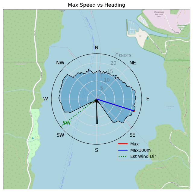
| Max | 22.1 | 40.9 |
| Max 100m | 21.7 | 40.2 |
| Max 250m | 21.4 | 39.7 |
| Max 500m | 20.9 | 38.7 |
| Max 2s | 21.9 | 40.6 |
| Max 10s | 21.7 | 40.2 |
| Max Alpha (500/50m) | 18.1 | 33.5 |
| Avg Foiling | 16.5 | 30.6 |
Times and Duration
| Start | Sun Jun 23, 11:11 AM |
| End | Sun Jun 23, 3:44 PM |
| Duration | 04:33:29 |
| In motion | 03:46:21 |
| Paused (< 3 km/h) | 00:08:37 |
| Foiling | 03:15:06 |
| Not Foiling (< 8 km/h) | 00:39:52 |
| Longest Foiling Segment | 00:49:45 (26.8 km) |
| Last Calculated | Tue Jul 02, 5:55 PM |
Track Information
| Distance | 103.1 km |
| # Trackpoints | 13840 |
| Avg Trackpoint distance | 7.4 m |
| Number of Turns | 116 |
| Foiling Turns (> 8 km/h) | 96 |
| Foiling Turn Percentage | 83% |


Category: Windfoiling
5 months ago

Created 5 months ago
Bobson |
Please register/login to download this track.
This track was downloaded 0 time(s). |
| 35 Swell beckons |
| 31 Clover week |
| 41 Double rainbowwww |
| 32 aCloverBalmyBombo |
| 28 Maytag day at IV 20241122 |
Please wait while loading suggestions..
Please wait while loading suggestions..
You must login to post comments.