NN - July 10 - Windfoil
Bobson - Windfoiling |
Wednesday July 10, 2024 4:05 PM |
| Spot | Nitinat Lk |
| Conditions | W 25-30, Wavy |
| TOW | 1.0 hours |
| Toys | 85cm Starboard Mast |
| 115 Starboard Evolution Fuse | |
| 900 Starboard Evolution Foil | |
| 255 SLR Starboard Stabilizer | |
| 4.5 Sailworks Flyer | |
| 150 Starboard Freeride | |
| Details | Too windy for my 5.0m Wing so jumped on the 4.5m Sailworks Flyer. Still over powered but manageable. Kid was stuck downwind so headed down to make sure she was okay. Her dad came and left to get a rescue but couldn't get one so he returned 30 mins later and towed his daughter to the fish hatchery. I headed back. Decided it was too windy so called it a day. And grabbed a fairly cold.corona. TIRED BOBSON OUT!! [from Session Log on Wednesday July 10, 2024] |
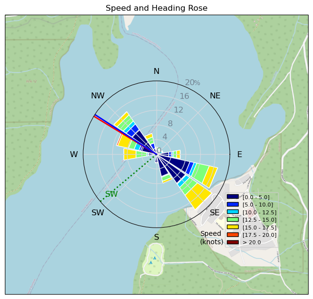
Speed (3s average)
| Speed | knots | km/h |
|---|---|---|
| Avg overall | 7.6 | 14.0 |
| Avg in motion | 9.7 | 18.0 |
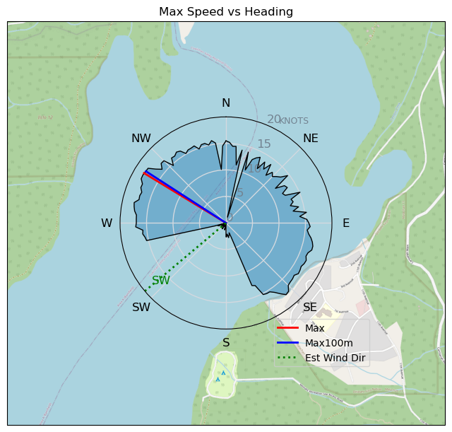
| Max | 18.1 | 33.5 |
| Max 100m | 17.8 | 33.0 |
| Max 250m | 17.3 | 32.0 |
| Max 500m | 17.1 | 31.6 |
| Max 2s | 18.1 | 33.5 |
| Max 10s | 17.9 | 33.1 |
| Max Alpha (500/50m) | 14.0 | 25.9 |
| Avg Foiling | 13.3 | 24.7 |
Times and Duration
| Start | Wed Jul 10, 4:05 PM |
| End | Wed Jul 10, 5:00 PM |
| Duration | 00:54:18 |
| In motion | 00:42:27 |
| Paused (< 3 km/h) | 00:11:12 |
| Foiling | 00:26:51 |
| Not Foiling (< 8 km/h) | 00:26:48 |
| Longest Foiling Segment | 00:11:51 (5.5 km) |
| Last Calculated | Fri Jul 12, 9:09 AM |
Track Information
| Distance | 12.7 km |
| # Trackpoints | 3258 |
| Avg Trackpoint distance | 3.9 m |
| Number of Turns | 26 |
| Foiling Turns (> 8 km/h) | 13 |
| Foiling Turn Percentage | 50% |


Category: Windfoiling
5 months ago

Created 5 months ago
Bobson |
Please register/login to download this track.
This track was downloaded 0 time(s). |
| 29 Swell beckons |
| 26 Clover week |
| 36 Double rainbowwww |
| 31 aCloverBalmyBombo |
| 28 Maytag day at IV 20241122 |
Please wait while loading suggestions..
Please wait while loading suggestions..
You must login to post comments.