July 23 Lake Nitinaht
JCH - Kitesurfing |
Tuesday July 23, 2024 6:23 PM |
| Spot | Nitinat Lk |
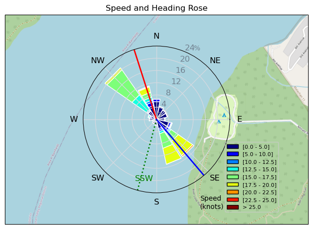
| Conditions | WSW 15-18, Sunny, cirrus clouds |
| TOW | 0.5 hours |
| Toys | 13 Duotone Juice DLab |
| 5.8 Dakin Liquid FORCE | |
| Details | Late going' forgot to close my dry suite' dummy. Was wet in a dry suit. Picked the wrong size kite with the surfboard. Should have used an 11m kite, maybe even my 10m. It was not my best session. Kiting on a surfboard is a brand new adventure. It is different than a twin tip. Need to let the fins do the work, not the edge. Did not get upwind as much as I wanted, but with the wind strength we had, I should have been able to get upwind much better. Also, my jibs sucked. Put too much weight on the back once toe side and sunk. More time on the water will help me solve those issues. [from Session Log on Tuesday July 23, 2024] |
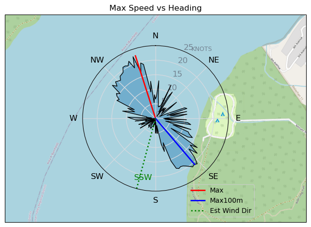
Speed (3s average)
| Speed | knots | km/h |
|---|---|---|
| Avg overall | 8.2 | 15.2 |
| Avg in motion | 12.4 | 23.0 |
| Max | 22.6 | 41.8 |
| Max 100m | 20.3 | 37.6 |
| Max 250m | 18.9 | 35.0 |
| Max 500m | 18.6 | 34.5 |
| Max 2s | 22.4 | 41.5 |
| Max 10s | 20.3 | 37.6 |
| Max Alpha (500/50m) | 15.3 | 28.4 |
| Avg Planing | 15.1 | 27.9 |
Times and Duration
| Start | Tue Jul 23, 6:23 PM |
| End | Tue Jul 23, 7:07 PM |
| Duration | 00:44:20 |
| In motion | 00:29:18 |
| Paused (< 3 km/h) | 00:10:30 |
| Planing | 00:22:20 |
| Not Planing (< 8 km/h) | 00:17:28 |
| Longest Planing Segment | 00:02:53 (1.3 km) |
| Last Calculated | Tue Jul 23, 10:02 PM |
Track Information
| Distance | 11.2 km |
| # Trackpoints | 2582 |
| Avg Trackpoint distance | 4.3 m |
| Number of Turns | 14 |
| Planing Turns (> 8 km/h) | 5 |
| Planing Turn Percentage | 36% |


Category: Kitesurfing
5 months ago
Created 5 months ago
JCH |
Please register/login to download this track.
This track was downloaded 0 time(s). |
Please wait while loading suggestions..
Please wait while loading suggestions..
You must login to post comments.