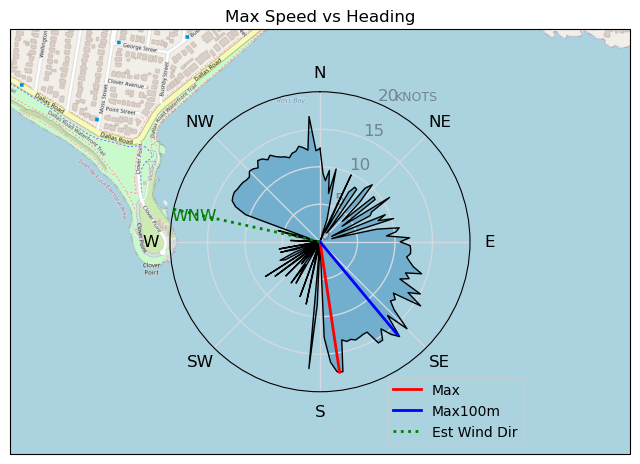
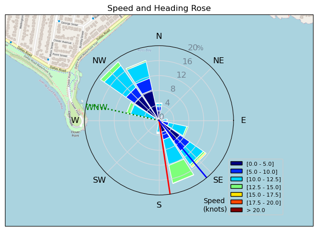
20240927
ThePope - Wingfoiling |
Friday September 27, 2024 10:50 AM |
| Spot | Ross Bay |
| Conditions | SW 10-15, 0.5m |
| TOW | 1.3 hours |
| Toys | 99L Armstrong FG Wing SUP |
| 7m Duotone Ventis | |
| 1475 Armstrong MA | |
| 70 Armstrong Fuse | |
| 865 Armstrong Mast | |
| 235 Armstrong Flow | |
| Popemobile | |
| Details | Gorgeous sunny day with light but steady breeze and flat water! Things were looking dismal when I arrived: only Rupert on the water but making his way back to shore due to lack of wind. I felt optimistic so I rigged all the big gear. As soon as I did the breeze started filling in, so I launched and was foiling right off the beach. Rupert relaunched and it was just the two of us for about an hour -- big time deja vu of our romantic sunset/moon session just a few weeks ago. Paul and DrMark joined, but sadly I had a 1pm meeting so I had to pack it up after after an hour or so. Chatted with GregCan and BWD as they were rigging. Happy to have got a session in before I go away for 10 days tomorrow! [from Session Log on Friday September 27, 2024] |
Speed (3s average)
| Speed | knots | km/h |
|---|---|---|
| Avg overall | 5.7 | 10.5 |
| Avg in motion | 7.4 | 13.6 |
| Max | 17.6 | 32.6 |
| Max 100m | 15.9 | 29.4 |
| Max 250m | 13.8 | 25.5 |
| Max 500m | 12.5 | 23.2 |
| Max 2s | 17.5 | 32.5 |
| Max 10s | 17.0 | 31.5 |
| Max Alpha (500/50m) | 10.9 | 20.2 |
| Avg Foiling | 10.4 | 19.3 |
Times and Duration
| Start | Fri Sep 27, 10:50 AM |
| End | Fri Sep 27, 12:06 PM |
| Duration | 01:15:40 |
| In motion | 00:58:08 |
| Paused (< 3 km/h) | 00:17:08 |
| Foiling | 00:32:51 |
| Not Foiling (< 8 km/h) | 00:42:25 |
| Longest Foiling Segment | 00:02:55 (998 m) |
| Last Calculated | Fri Sep 27, 4:12 PM |
Track Information
| Distance | 13.2 km |
| # Trackpoints | 2822 |
| Avg Trackpoint distance | 4.7 m |
| Number of Turns | 12 |
| Foiling Turns (> 8 km/h) | 2 |
| Foiling Turn Percentage | 17% |


Category: Wingfoiling
one month ago

Created one month ago
ThePope |
Please register/login to download this track.
This track was downloaded 0 time(s). |
| 33 241120 Willows |
| 40 Willows Bomb Session |
| 40 Shoot the Entrance |
| 31 CloverPartDeux |
| 24 Come back soon Bombo |
Please wait while loading suggestions..
Please wait while loading suggestions..
You must login to post comments.