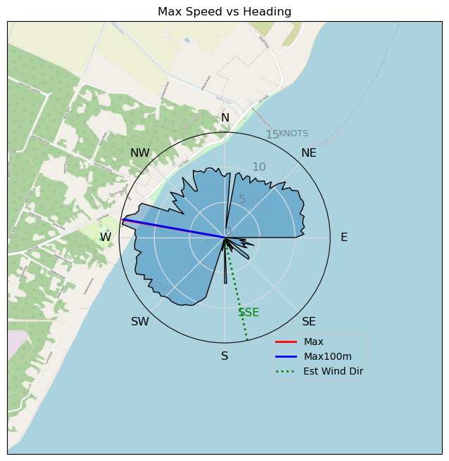
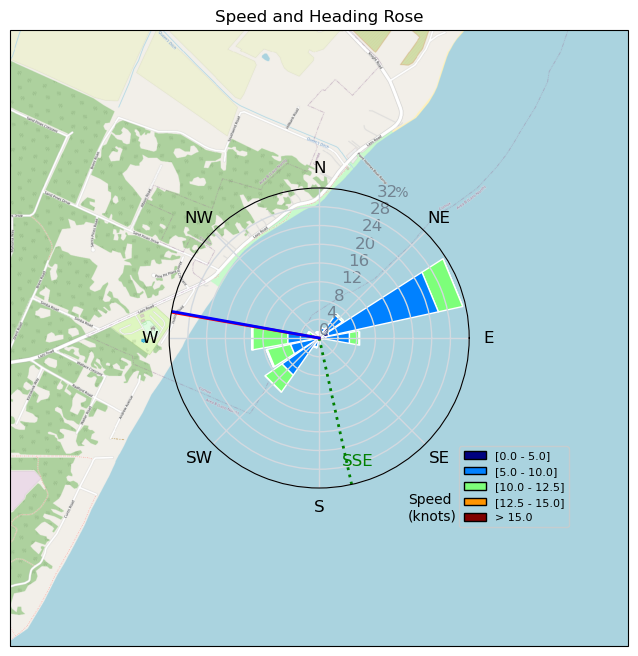
Pt.Holmes 10/29
mayday - Wingfoiling |
Tuesday October 29, 2024 3:15 PM |
| Spot | Comox Spit |
| Conditions | SE 15-20, swell |
| TOW | 1.5 hours |
| Toys | 115 quattro drifter |
| 6m duotone slick | |
| 1880 reedin flight attendant | |
| Details | Well, that's going to take some getting used to- after 2.5yrs ( day 0 to now) on the same large foil (1880) finally got a smaller one ( 1220). Got out as it was building, and at first thought maybe I'd wasted the $ - was definitely more responsive, but not dramatically- but as the swell picked up, it came alive! Running downwind was a blast - way faster than I'm used to, but looking forward to getting to know it better. Finally had to admit i was way overpowered on the 6m and come in. Fun. [from Session Log on Tuesday October 29, 2024] |
Speed (3s average)
| Speed | knots | km/h |
|---|---|---|
| Avg overall | 8.3 | 15.3 |
| Avg in motion | 9.1 | 16.8 |
| Max | 14.7 | 27.2 |
| Max 100m | 13.3 | 24.6 |
| Max 250m | 11.8 | 21.8 |
| Max 500m | 11.4 | 21.0 |
| Max 2s | 14.6 | 27.1 |
| Max 10s | 13.9 | 25.7 |
| Max Alpha (500/50m) | 10.3 | 19.1 |
| Avg Foiling | 9.5 | 17.7 |
Times and Duration
| Start | Tue Oct 29, 3:15 PM |
| End | Tue Oct 29, 5:03 PM |
| Duration | 01:47:59 |
| In motion | 01:38:29 |
| Paused (< 3 km/h) | 00:08:23 |
| Foiling | 01:29:44 |
| Not Foiling (< 8 km/h) | 00:17:08 |
| Longest Foiling Segment | 00:22:37 (6.7 km) |
| Last Calculated | Tue Oct 29, 5:33 PM |
Track Information
| Distance | 27.5 km |
| # Trackpoints | 6465 |
| Avg Trackpoint distance | 4.3 m |
| Number of Turns | 34 |
| Foiling Turns (> 8 km/h) | 17 |
| Foiling Turn Percentage | 50% |


Category: Wingfoiling
4 weeks ago

Created 4 weeks ago
mayday |
Please register/login to download this track.
This track was downloaded 0 time(s). |
| 18 241120 Willows |
| 21 Willows Bomb Session |
| 26 Shoot the Entrance |
| 22 CloverPartDeux |
| 11 Come back soon Bombo |
Please wait while loading suggestions..
Please wait while loading suggestions..
You must login to post comments.