Shoot the Entrance
TunaCan - Wingfoiling |
Wednesday November 20, 2024 10:56 AM |
| Spot | [Secret spot] |
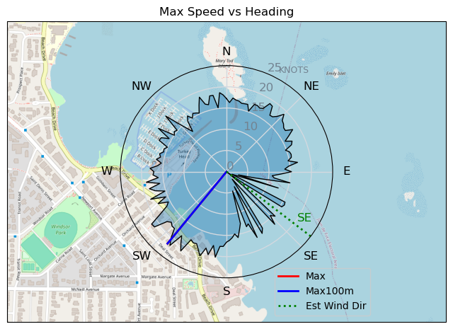
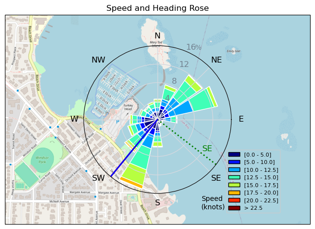
| Conditions | ESE 20-30, waist at times |
| TOW | 1.0 hours |
| Details | Full day off with sun and wind in the forecast had me excited. Saw PuffDaddy and some other kiters out off Turkey Head earlier looking like they were having a blast. Quick breakfast at the Oaks with the family and Tweezer hit me with a text that his name sake spot was going off. On arrival Tweezer and Windoc were out shredding, with conditions looking very good. Proceeded to have one of the more memorable sessions of the year for me. Great wave rides, a couple large boosts, and even shot the marina entrance from both ways! Went in halfway thru to take the gloves off as they were giving me horrible arm pump, and the hands didnt even get cold after. Took a break and had a sneaky second session at Willows. [from Session Log on Wednesday November 20, 2024] |
Speed (3s average)
| Speed | knots | km/h |
|---|---|---|
| Avg overall | 9.3 | 17.3 |
| Avg in motion | 11.9 | 22.1 |
| Max | 21.9 | 40.6 |
| Max 100m | 20.8 | 38.5 |
| Max 250m | 18.7 | 34.7 |
| Max 500m | 16.3 | 30.3 |
| Max 2s | 21.8 | 40.4 |
| Max 10s | 20.7 | 38.4 |
| Max Alpha (500/50m) | 15.4 | 28.5 |
| Avg Foiling | 13.6 | 25.2 |
Times and Duration
| Start | Wed Nov 20, 10:56 AM |
| End | Wed Nov 20, 12:20 PM |
| Duration | 01:23:39 |
| In motion | 01:05:37 |
| Paused (< 3 km/h) | 00:09:44 |
| Foiling | 00:53:11 |
| Not Foiling (< 8 km/h) | 00:22:10 |
| Longest Foiling Segment | 00:08:33 (3.9 km) |
| Last Calculated | Wed Nov 20, 7:24 PM |
Track Information
| Distance | 24.1 km |
| # Trackpoints | 4425 |
| Avg Trackpoint distance | 5.4 m |
| Number of Turns | 95 |
| Foiling Turns (> 8 km/h) | 70 |
| Foiling Turn Percentage | 74% |


Category: Wingfoiling
4 hours ago

Created 4 hours ago
TunaCan |
Please register/login to download this track.
This track was downloaded 0 time(s). |
| 13 241120 Willows |
| 15 Willows Bomb Session |
| 20 Shoot the Entrance |
| 18 CloverPartDeux |
| 9 Come back soon Bombo |
Please wait while loading suggestions..
Please wait while loading suggestions..
You must login to post comments.