Pt.Holmes 12/24
mayday - Wingfoiling |
Tuesday December 24, 2024 8:44 AM |
| Spot | Comox Spit |
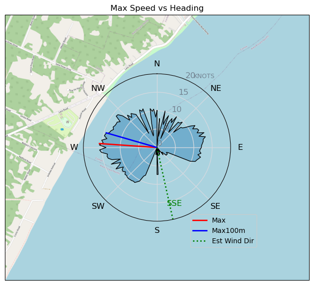
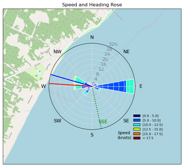
| Conditions | SSE 20-25, 1m swell |
| TOW | 1.0 hours |
| Toys | 115 quattro drifter |
| 5m duotone slick sls | |
| 1220 reedin flight attendant | |
| Details | Sometimes that line between good idea and catastrophe is razor thin - and this morning I walked it. Solid 20kts as i was gearing up, but by the time I got out, it was a pretty consistent 25. A smart person would have either A) gone in for the 4m, or better yet B) gone over to the spit fishbowl. Unfortunately there were no smart people around, and i continued. Long story short, turned out to be an excellent session, with some really good rides. Wind actually eased just as i was coming in. Merry Christmas to me :-) [from Session Log on Tuesday December 24, 2024] |
Speed (3s average)
| Speed | knots | km/h |
|---|---|---|
| Avg overall | 7.9 | 14.6 |
| Avg in motion | 9.0 | 16.6 |
| Max | 15.7 | 29.0 |
| Max 100m | 14.3 | 26.4 |
| Max 250m | 12.3 | 22.9 |
| Max 500m | 11.8 | 21.8 |
| Max 2s | 15.7 | 29.0 |
| Max 10s | 14.8 | 27.3 |
| Max Alpha (500/50m) | 11.1 | 20.5 |
| Avg Foiling | 9.7 | 18.0 |
Times and Duration
| Start | Tue Dec 24, 8:44 AM |
| End | Tue Dec 24, 9:51 AM |
| Duration | 01:06:12 |
| In motion | 00:58:20 |
| Paused (< 3 km/h) | 00:05:53 |
| Foiling | 00:50:24 |
| Not Foiling (< 8 km/h) | 00:13:49 |
| Longest Foiling Segment | 00:07:46 (2.4 km) |
| Last Calculated | Tue Dec 24, 10:11 AM |
Track Information
| Distance | 16.2 km |
| # Trackpoints | 3930 |
| Avg Trackpoint distance | 4.1 m |
| Number of Turns | 25 |
| Foiling Turns (> 8 km/h) | 12 |
| Foiling Turn Percentage | 48% |


Category: Wingfoiling
Yesterday

Created Yesterday
mayday |
Please register/login to download this track.
This track was downloaded 0 time(s). |
| 24 Eve Slide |
| 24 241224 Ross Bay |
| 20 RB - Xmas Eve Excellence |
| 28 Last 2024 Victoria Session -- Happy Holidays!! |
| 23 NoGloveLove |
Please wait while loading suggestions..
Please wait while loading suggestions..
You must login to post comments.