All da tings
winddoctor - Wingfoiling |
Saturday December 28, 2024 12:45 PM |
| Spot | Ross Bay |
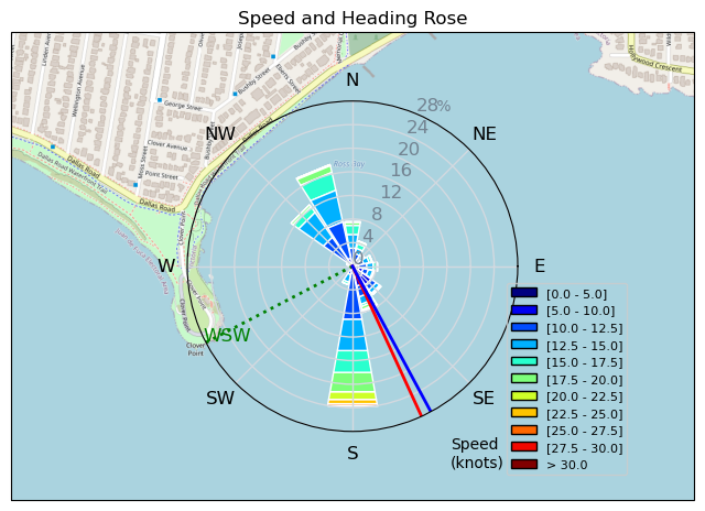
| Conditions | W 25-35, 2-4 |
| TOW | 2.0 hours |
| Toys | 110 KT Dragonfly 2 |
| 62L KT Ginxu 2 | |
| 3 KT DD | |
| 680cm2 Armstrong HA 680 | |
| 1080 Armstrong HA | |
| 935 Armstrong Performance | |
| Armstrong Dart 140 | |
| Armstrong Speed 180 | |
| 795 Armstrong Performance | |
| Details | Such a fun session! Rode all the things. Started with the 2.9 Parawing and had some good success! Stowing happened a little easier today and funny enough I thought I was riding the 880HA and was thinking "Man, I love this foil. So turny and glidey". Turns out it was the 1080 that I put on last time I was SUP foiling, LOL. Started getting OP'd, so went back in for the 3M wing. That was fun for a bit, then the wind picked up a bit more and swell increased. Back in for the 62L Ginxu and 680HA. Ah, that's better! Some fantastic rides off Clover and only one stick take-down. High stoke day! So nice when all the kit works so well. Knee felt great today too, so that's a relief! Lots of Happy sailors. [from Session Log on Saturday December 28, 2024] |
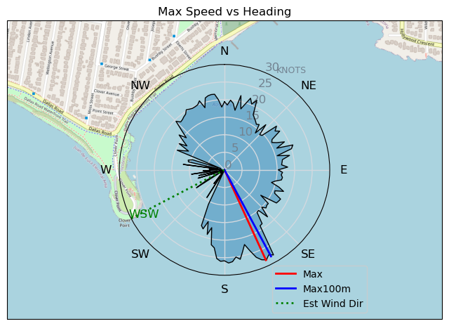
Speed (3s average)
| Speed | knots | km/h |
|---|---|---|
| Avg overall | 7.9 | 14.7 |
| Avg in motion | 12.6 | 23.3 |
| Max | 28.3 | 52.4 |
| Max 100m | 26.7 | 49.4 |
| Max 250m | 22.1 | 40.9 |
| Max 500m | 18.2 | 33.7 |
| Max 2s | 28.1 | 52.1 |
| Max 10s | 26.0 | 48.2 |
| Max Alpha (500/50m) | 17.2 | 31.8 |
| Avg Foiling | 13.0 | 24.2 |
Times and Duration
| Start | Sat Dec 28, 12:45 PM |
| End | Sat Dec 28, 2:42 PM |
| Duration | 01:56:22 |
| In motion | 01:13:18 |
| Paused (< 3 km/h) | 00:42:07 |
| Foiling | 01:08:25 |
| Not Foiling (< 8 km/h) | 00:47:00 |
| Longest Foiling Segment | 00:14:18 (6.4 km) |
| Last Calculated | Sat Dec 28, 5:30 PM |
Track Information
| Distance | 28.4 km |
| # Trackpoints | 4317 |
| Avg Trackpoint distance | 6.6 m |
| Number of Turns | 75 |
| Foiling Turns (> 8 km/h) | 65 |
| Foiling Turn Percentage | 87% |


Category: Wingfoiling
3 weeks ago

Created 3 weeks ago
winddoctor |
Please register/login to download this track.
This track was downloaded 0 time(s). |
| 17 Gonna die but when? |
| 48 BWD got me addicted |
| 89 Falck’n Foot Switches |
| 79 250112 Cattle Point |
| 77 Speedy (for me) wave riding |
Please wait while loading suggestions..
Please wait while loading suggestions..
You must login to post comments.