Onwards to the 12th dimension
ThePope - Wingfoiling |
Friday January 10, 2025 6:28 PM |
| Spot | [Secret spot] |
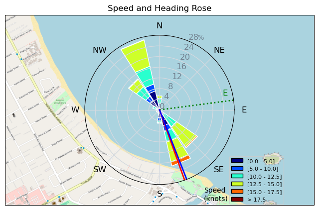
| Conditions | ENE 12-16, 1m-1.5m |
| TOW | 1.5 hours |
| Toys | 70 Armstrong Fuse |
| 865 Armstrong Mast | |
| 220 Armstrong Glide | |
| 1080 Armstrong HA | |
| 7m Duotone Ventis | |
| 99L Armstrong FG Wing SUP | |
| Details | Another super light wind session on all the huge gear - challenging conditions for gybe practice. Gybevoidance relapse. When I first started to make gybe attempts my mind would start racing with all of the technical things that garnished from endless foiling YouTube videos, and also all of the potential catastrophes that were about to befall me. I tend to overthink things, and I've found that calming my mind as I go into a gybe has helped a lot. Deep breath, make the turn, go through the hand work, point in the right direction, no prob. If you're gonna bail, do it in a way where you don't land on the board or damage equipment. Calm the mind - one step closer to the 12th dimension. Step 5 complete! [from Session Log on Friday January 10, 2025] |
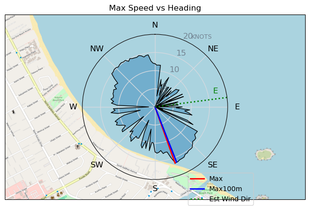
Speed (3s average)
| Speed | knots | km/h |
|---|---|---|
| Avg overall | 7.0 | 13.0 |
| Avg in motion | 8.5 | 15.7 |
| Max | 16.5 | 30.5 |
| Max 100m | 16.2 | 29.9 |
| Max 250m | 15.6 | 28.9 |
| Max 500m | 14.9 | 27.6 |
| Max 2s | 16.4 | 30.4 |
| Max 10s | 16.2 | 30.0 |
| Max Alpha (500/50m) | 11.3 | 20.9 |
| Avg Foiling | 11.4 | 21.2 |
Times and Duration
| Start | Fri Jan 10, 6:28 PM |
| End | Fri Jan 10, 8:04 PM |
| Duration | 01:36:33 |
| In motion | 01:20:06 |
| Paused (< 3 km/h) | 00:16:04 |
| Foiling | 00:51:08 |
| Not Foiling (< 8 km/h) | 00:45:02 |
| Longest Foiling Segment | 00:05:00 (2.0 km) |
| Last Calculated | Fri Jan 10, 9:11 PM |
Track Information
| Distance | 20.9 km |
| # Trackpoints | 3965 |
| Avg Trackpoint distance | 5.3 m |
| Number of Turns | 19 |
| Foiling Turns (> 8 km/h) | 3 |
| Foiling Turn Percentage | 16% |


Category: Wingfoiling
6 hours ago

Created 6 hours ago
ThePope |
Please register/login to download this track.
This track was downloaded 0 time(s). |
| 18 10/1/2025 Ross Bay |
| 31 2025NumeroUno |
| 26 Onwards to the 12th dimension |
| 30 RB omg best day of the year |
| 26 250110 Ross Bay |
Please wait while loading suggestions..
Please wait while loading suggestions..
You must login to post comments.