Cruising altitude
ThePope - Wingfoiling |
Monday January 20, 2025 12:30 PM |
| Spot | [Secret spot] |
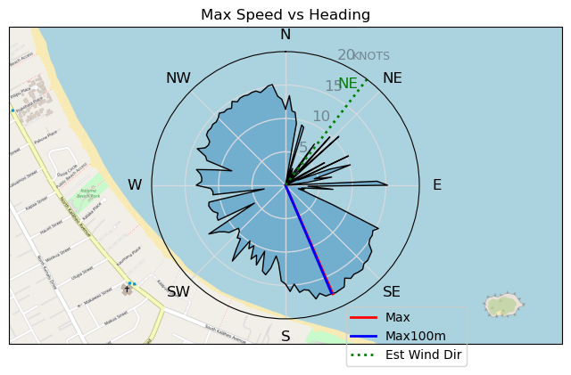
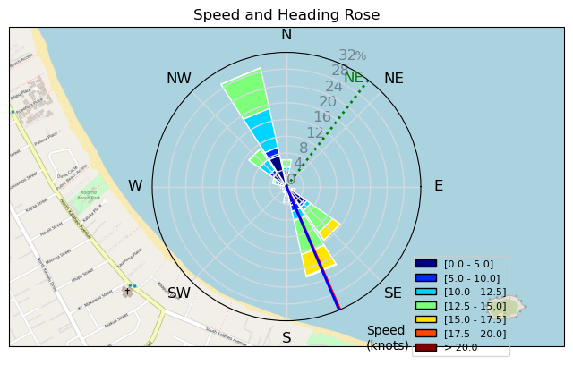
| Conditions | NE 10-15, 1m |
| TOW | 2.0 hours |
| Toys | 99L Armstrong FG Wing SUP |
| 5.5m Duotone Unit SLS | |
| 1080 Armstrong HA | |
| 220 Armstrong Glide | |
| 865 Armstrong Mast | |
| 70 Armstrong Fuse | |
| Details | It was like a toddler had control of the off/on switch for the wind today. A squall would rip through, then almost no wind for 20 minutes and I just bobbed around and waited for the next squall. About an hour into the session the wind finally became a bit more steady. When gybing in bigger waves I sometimes struggle to find the sweet spot between: 1) being too high on the mast and breaching as I come down the wave, and 2) being too low on the mast and touching down or nose diving. There's a good amount of stored potential energy when you're relatively high on the mast, and this can come in handy when maneuvering through a gybe. Starting high and then slowly dropping your altitude throughout the gybe can help to power you through it. Proper altitude, or mast height, is the final step (thank God) in this convoluted 12-step gybe rehab that they sent me to after the intervention. [from Session Log on Monday January 20, 2025] |
Speed (3s average)
| Speed | knots | km/h |
|---|---|---|
| Avg overall | 6.2 | 11.4 |
| Avg in motion | 8.6 | 15.9 |
| Max | 17.8 | 32.9 |
| Max 100m | 17.5 | 32.3 |
| Max 250m | 17.2 | 31.9 |
| Max 500m | 16.6 | 30.8 |
| Max 2s | 17.7 | 32.8 |
| Max 10s | 17.5 | 32.4 |
| Max Alpha (500/50m) | 11.3 | 20.9 |
| Avg Foiling | 12.1 | 22.5 |
Times and Duration
| Start | Mon Jan 20, 12:30 PM |
| End | Mon Jan 20, 2:33 PM |
| Duration | 02:02:39 |
| In motion | 01:27:59 |
| Paused (< 3 km/h) | 00:34:36 |
| Foiling | 00:53:02 |
| Not Foiling (< 8 km/h) | 01:09:33 |
| Longest Foiling Segment | 00:03:18 (1.4 km) |
| Last Calculated | Mon Jan 20, 3:14 PM |
Track Information
| Distance | 23.3 km |
| # Trackpoints | 4353 |
| Avg Trackpoint distance | 5.4 m |
| Number of Turns | 21 |
| Foiling Turns (> 8 km/h) | 9 |
| Foiling Turn Percentage | 43% |


Category: Wingfoiling
Yesterday

Created Yesterday
ThePope |
Please register/login to download this track.
This track was downloaded 0 time(s). |
| 22 CP - Jan 19 2025 |
| 45 Cruising altitude |
| 42 DesperadoRedux |
| 43 250119 Cattle Point |
| 48 CP - Sunday Funday On the Water |
Please wait while loading suggestions..
Please wait while loading suggestions..
You must login to post comments.