CP - Light Wind, Low Tide
Bobson - Windfoiling |
Friday March 15, 2024 3:14 PM |
| Spot | Cattle Pt |
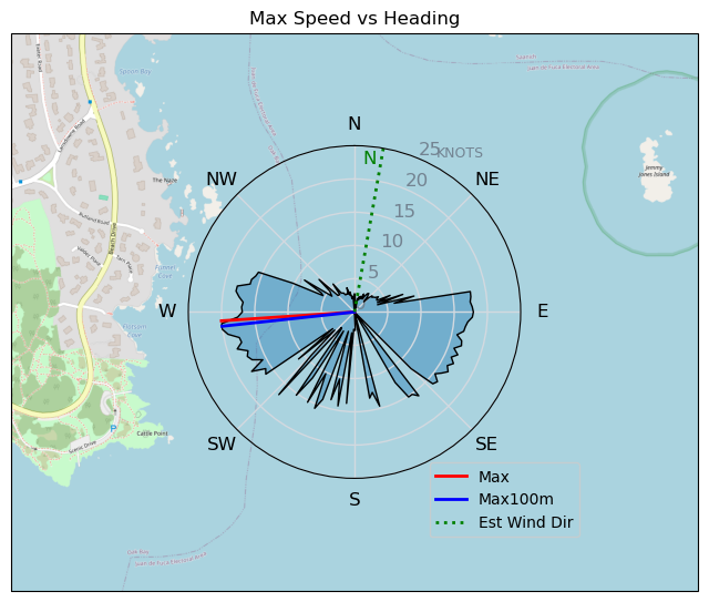
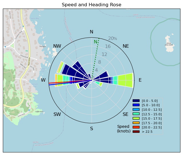
| Conditions | NE 8-11, flat |
| TOW | 0.8 hours |
| Toys | 255 SLR Starboard Stabilizer |
| 900 Starboard Evolution Foil | |
| 115 Starboard Evolution Fuse | |
| 85cm Starboard Mast | |
| 7.0 Sailworks Flyer | |
| 150 Starboard Freeride | |
| Details | Arrived to a low tide and low wind. Met Rupp-Dogg in the parking lot and we chatted for a minute and then I rigged up the 7.0m Sailworks Flyer. Took a couple mins to find a gust then foiled for 10-15 mins then it was lighter so was a pump-fest with only a few more foiling runs. It was just too nice out to not try. Sunny and Warm, YES, Warm!! I think Rupp-Dogg used me as a Wind-dummy. Probably smart not to go out as it was pretty light. I probably need to start Winging soon. Probably. BOBSON OUT!! [from Session Log on Friday March 15, 2024] |
Speed (3s average)
| Speed | knots | km/h |
|---|---|---|
| Avg overall | 6.2 | 11.6 |
| Avg in motion | 6.4 | 11.8 |
| Max | 20.1 | 37.2 |
| Max 100m | 19.6 | 36.3 |
| Max 250m | 18.1 | 33.6 |
| Max 500m | 17.0 | 31.4 |
| Max 2s | 20.1 | 37.1 |
| Max 10s | 19.6 | 36.3 |
| Max Alpha (500/50m) | 15.5 | 28.7 |
| Avg Foiling | 13.9 | 25.8 |
Times and Duration
| Start | Fri Mar 15, 3:14 PM |
| End | Fri Mar 15, 4:06 PM |
| Duration | 00:51:45 |
| In motion | 00:50:47 |
| Paused (< 3 km/h) | 00:00:56 |
| Foiling | 00:15:22 |
| Not Foiling (< 8 km/h) | 00:36:21 |
| Longest Foiling Segment | 00:08:52 (4.2 km) |
| Last Calculated | Fri Mar 15, 5:17 PM |
Track Information
| Distance | 10.0 km |
| # Trackpoints | 3105 |
| Avg Trackpoint distance | 3.2 m |
| Number of Turns | 15 |
| Foiling Turns (> 8 km/h) | 6 |
| Foiling Turn Percentage | 40% |


Category: Windfoiling
one month ago

Created one month ago
Bobson |
Please register/login to download this track.
This track was downloaded 0 time(s). |
| 20 Thursday 04/25 at Willows |
| 26 Tuesday Evening Foil Fest1 |
| 27 RB East on the DW |
| 26 240425 Willows Beach |
| 21 Kona RB |
Please wait while loading suggestions..
Please wait while loading suggestions..
You must login to post comments.