PreLuckOtheIrish
UnusuallyLargeRobin - Wingfoiling |
Saturday March 16, 2024 11:05 AM |
| Spot | Cattle Pt |
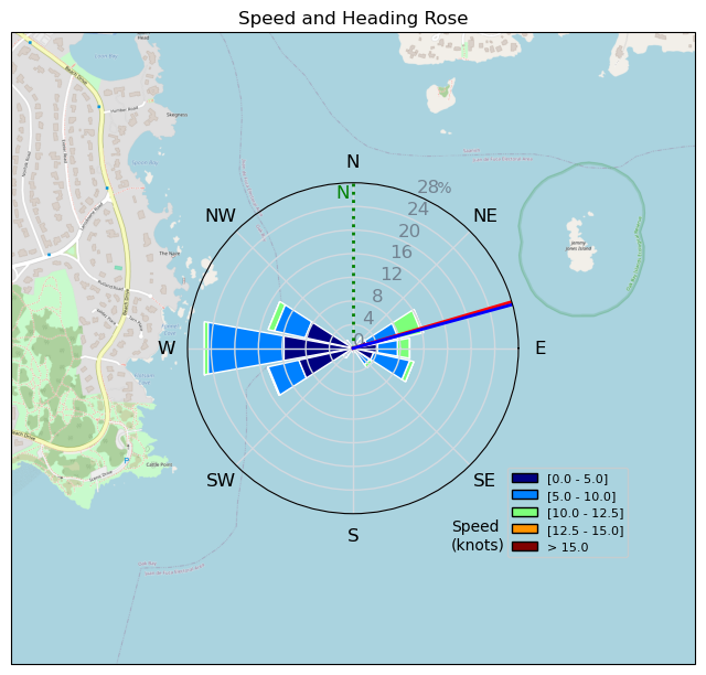
| Conditions | N 7-12, Flat |
| TOW | 1.0 hours |
| Toys | PNG 1150 (1713cm2) Axis Front Foil |
| 425 P Axis Rear Foil/Stab | |
| 90cm Axis Alu Mast | |
| 5.5 Duotone Unit | |
| 5'8 128lt Indiana Wing Foil Carbon | |
| Details | Took a chance and scored a beautiful hour of flying off Cattle this morning. Used the big gear and it performed with easy pop up and super low stall speed. Flitted around with the fleet sailing. Mtnarg, Bobson and i out, then joined later by RupDogPaddle. [from Session Log on Saturday March 16, 2024] |
Speed (3s average)
| Speed | knots | km/h |
|---|---|---|
| Avg overall | 3.1 | 5.8 |
| Avg in motion | 6.1 | 11.3 |
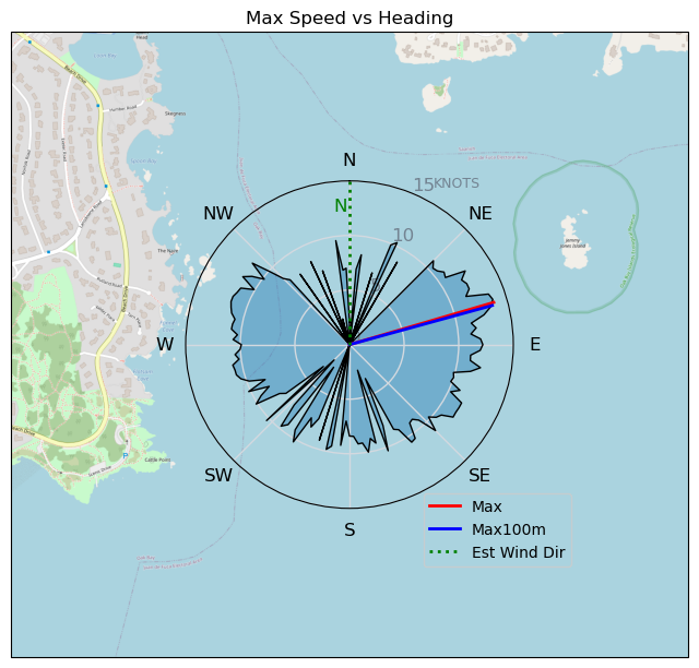
| Max | 13.8 | 25.5 |
| Max 100m | 12.6 | 23.4 |
| Max 250m | 10.3 | 19.1 |
| Max 500m | 10.1 | 18.6 |
| Max 2s | 13.7 | 25.3 |
| Max 10s | 13.2 | 24.4 |
| Max Alpha (500/50m) | 8.9 | 16.6 |
| Avg Foiling | 8.7 | 16.1 |
Times and Duration
| Start | Sat Mar 16, 11:05 AM |
| End | Sat Mar 16, 12:38 PM |
| Duration | 01:33:10 |
| In motion | 00:47:54 |
| Paused (< 3 km/h) | 00:02:00 |
| Foiling | 00:27:54 |
| Not Foiling (< 8 km/h) | 00:22:00 |
| Longest Foiling Segment | 00:09:17 (2.5 km) |
| Last Calculated | Sat Mar 16, 5:35 PM |
Track Information
| Distance | 9.1 km |
| # Trackpoints | 2934 |
| Avg Trackpoint distance | 3.1 m |
| Number of Turns | 23 |
| Foiling Turns (> 8 km/h) | 17 |
| Foiling Turn Percentage | 74% |


Category: Wingfoiling
6 weeks ago

Created 6 weeks ago
UnusuallyLargeRobin |
Please register/login to download this track.
This track was downloaded 0 time(s). |
| 21 Thursday 04/25 at Willows |
| 26 Tuesday Evening Foil Fest1 |
| 27 RB East on the DW |
| 26 240425 Willows Beach |
| 23 Kona RB |
Please wait while loading suggestions..
Please wait while loading suggestions..
You must login to post comments.