240318 Pipers
Highrocker - Wingfoiling |
Monday March 18, 2024 11:10 AM |
| Spot | Pipers Lgn |
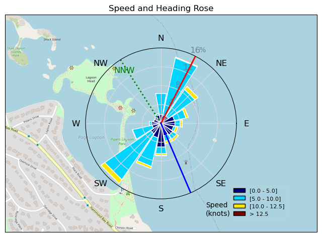
| Conditions | NW 15-20, 1-3ft swell |
| TOW | 1.5 hours |
| Toys | 900mm Axis Aluminum Mast |
| 2050sqcm Axis 1020mm Carbon Front Wing | |
| 5m Cabrinha X3 Windows | |
| 115L JP Australia Foil Pro | |
| Details | What a fantastic opening to the Piper's season for me with FraserMc, Danno, and locals DaveM and UdderReef. Sunshine, steady cross shore winds, friendly swells, easy tidal flow, even friendlier sea lions - I'd pay even more money than my $50 in gas to travel to this warm gem of a winging destination. Powered even in the bay as Danno and I played jibe tag until I eventually tired out. Sad to have to leave so much wind still pumping as Danno and FMc hit the swells again. Thanks for the post-flight bevy Danno! [from Session Log on Monday March 18, 2024] |
Speed (3s average)
| Speed | knots | km/h |
|---|---|---|
| Avg overall | 4.9 | 9.0 |
| Avg in motion | 7.8 | 14.4 |
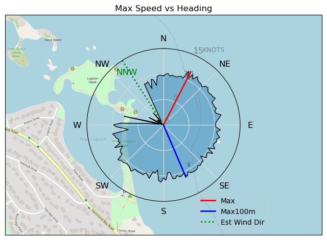
| Max | 11.6 | 21.5 |
| Max 100m | 10.5 | 19.4 |
| Max 250m | 10.0 | 18.5 |
| Max 500m | 9.8 | 18.1 |
| Max 2s | 11.6 | 21.5 |
| Max 10s | 11.0 | 20.5 |
| Max Alpha (500/50m) | 9.7 | 17.9 |
| Avg Foiling | 8.4 | 15.5 |
Times and Duration
| Start | Mon Mar 18, 11:10 AM |
| End | Mon Mar 18, 1:26 PM |
| Duration | 02:15:50 |
| In motion | 01:24:59 |
| Paused (< 3 km/h) | 00:44:09 |
| Foiling | 01:12:47 |
| Not Foiling (< 8 km/h) | 00:56:21 |
| Longest Foiling Segment | 00:18:41 (4.7 km) |
| Last Calculated | Mon Mar 18, 10:08 PM |
Track Information
| Distance | 20.4 km |
| # Trackpoints | 3955 |
| Avg Trackpoint distance | 5.2 m |
| Number of Turns | 104 |
| Foiling Turns (> 8 km/h) | 55 |
| Foiling Turn Percentage | 53% |


Category: Wingfoiling
6 weeks ago

Created 6 weeks ago
Highrocker |
Please register/login to download this track.
This track was downloaded 0 time(s). |
| 21 Thursday 04/25 at Willows |
| 26 Tuesday Evening Foil Fest1 |
| 27 RB East on the DW |
| 26 240425 Willows Beach |
| 24 Kona RB |
Please wait while loading suggestions..
Please wait while loading suggestions..
You must login to post comments.