IV - Humpty Pump
Bobson - Windfoiling |
Wednesday March 20, 2024 1:56 PM |
| Spot | Island View |
| Conditions | SE 8-12, mostly flat |
| TOW | 1.2 hours |
| Toys | 85cm Starboard Mast |
| 255 SLR Starboard Stabilizer | |
| 900 Starboard Evolution Foil | |
| 115 Starboard Evolution Fuse | |
| 7.0 Sailworks Flyer | |
| 150 Starboard Freeride | |
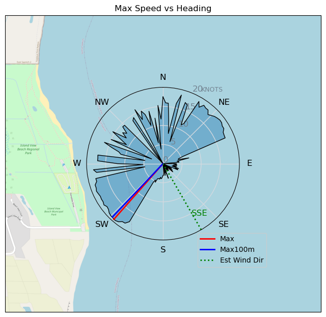
| Details | Saw some wind at IV so took the afternoon off, first lunch with daughter then BOOM, hit the water. As I arrived it looked like 10-12kts, got out and foiled right away for awhile then it backed off to 8-10kts schlogged for a bit then it picked up a couple kts and was flying again. Looked like it was getting lighter again so pulled the shute. I was going to play with the Wing on the beach but decided going home and opening up my new board that arrived today. Good choice!! It's Pristine. Celebrated with an ice cold Corona! Doesn't look like any wind tomorrow.....BUTT, Friday and Saturday look good.....and when I say good, I mean 10-15kts from the North, might even be Wing-able on Saturday at IV. Maybe' Ding! BOBSON OUT!! [from Session Log on Wednesday March 20, 2024] |
Speed (3s average)
| Speed | knots | km/h |
|---|---|---|
| Avg overall | 7.7 | 14.2 |
| Avg in motion | 7.8 | 14.5 |
| Max | 19.5 | 36.0 |
| Max 100m | 19.2 | 35.5 |
| Max 250m | 19.0 | 35.1 |
| Max 500m | 18.6 | 34.4 |
| Max 2s | 19.4 | 35.9 |
| Max 10s | 19.2 | 35.5 |
| Max Alpha (500/50m) | 16.6 | 30.8 |
| Avg Foiling | 13.9 | 25.7 |
Times and Duration
| Start | Wed Mar 20, 1:56 PM |
| End | Wed Mar 20, 3:07 PM |
| Duration | 01:11:11 |
| In motion | 01:09:59 |
| Paused (< 3 km/h) | 00:01:06 |
| Foiling | 00:29:45 |
| Not Foiling (< 8 km/h) | 00:41:20 |
| Longest Foiling Segment | 00:12:31 (6.4 km) |
| Last Calculated | Wed Mar 20, 6:28 PM |
Track Information
| Distance | 16.9 km |
| # Trackpoints | 4271 |
| Avg Trackpoint distance | 4.0 m |
| Number of Turns | 16 |
| Foiling Turns (> 8 km/h) | 7 |
| Foiling Turn Percentage | 44% |


Category: Windfoiling
one month ago

Created one month ago
Bobson |
Please register/login to download this track.
This track was downloaded 0 time(s). |
| 7 DOG - Day 2 on DW board - Ross Bay - May 13 |
| 12 240513 Ross bay |
| 13 Clover foil 13May24 |
| 17 RB - Monday Sun & Swell |
| 16 20240513 |
Please wait while loading suggestions..
Please wait while loading suggestions..
You must login to post comments.