DOG - Ross Bay - April 02/24
rsmundell - Wingfoiling |
Tuesday April 02, 2024 6:06 PM |
| Spot | Ross Bay |
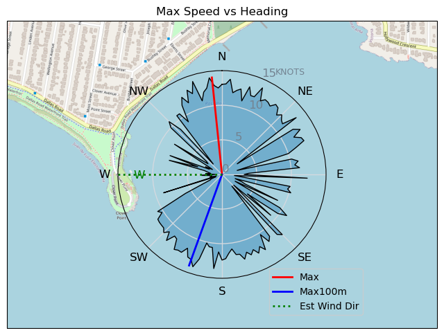
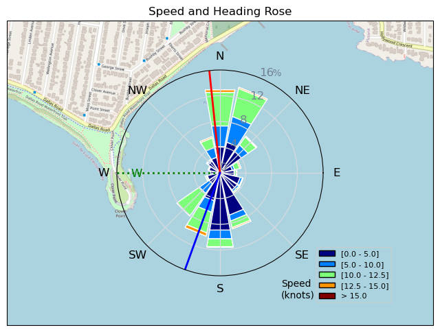
| Conditions | WNW 8-22, Swell and Chop |
| TOW | 1.5 hours |
| Toys | 85cm Takuma Carbon Mast |
| 1210/85/220? Takuma Wingfoil | |
| 80 Takuma Wingfoil Board | |
| Details | What a bizarre but amazingly fun combo of wind direction and waves! Heading upwind on stbd straight to the tip of CP with increasingly larger waves coming at you from your port bow! It was an odd way to see the waves coming but totally rideable and great for getting up-swell quickly! You could really head high as you pumped down the backs of each wave. Surfing with the waves had the wing flagging out for long periods due to angle and speed/size of the waves to the wind. ULR and I were out with a couple others (JJ?) until relatively late and the waves just kept getting bigger and better. Awesome rides, some of the longest I've had. Some much fun. [from Session Log on Wednesday April 03, 2024] |
Speed (3s average)
| Speed | knots | km/h |
|---|---|---|
| Avg overall | 4.5 | 8.4 |
| Avg in motion | 7.8 | 14.5 |
| Max | 14.1 | 26.1 |
| Max 100m | 13.1 | 24.3 |
| Max 250m | 12.4 | 22.9 |
| Max 500m | 11.6 | 21.5 |
| Max 2s | 14.1 | 26.1 |
| Max 10s | 13.3 | 24.6 |
| Max Alpha (500/50m) | 10.1 | 18.7 |
| Avg Foiling | 9.9 | 18.4 |
Times and Duration
| Start | Tue Apr 02, 6:06 PM |
| End | Tue Apr 02, 7:36 PM |
| Duration | 01:29:35 |
| In motion | 00:51:55 |
| Paused (< 3 km/h) | 00:37:29 |
| Foiling | 00:32:29 |
| Not Foiling (< 8 km/h) | 00:56:55 |
| Longest Foiling Segment | 00:07:05 (2.3 km) |
| Last Calculated | Wed Apr 03, 1:57 PM |
Track Information
| Distance | 12.5 km |
| # Trackpoints | 1906 |
| Avg Trackpoint distance | 6.6 m |
| Number of Turns | 42 |
| Foiling Turns (> 8 km/h) | 7 |
| Foiling Turn Percentage | 17% |


Category: Wingfoiling
4 weeks ago

Created 4 weeks ago
rsmundell |
Please register/login to download this track.
This track was downloaded 0 time(s). |
| 15 240429 Ross Bay |
| 17 RB - Best Wing Sesh So Far |
| 13 Sugar? Yes 2 lumps |
| 10 RB words out |
| 9 RB way back on Apr23 |
Please wait while loading suggestions..
Please wait while loading suggestions..
You must login to post comments.