Me&Debris
UnusuallyLargeRobin - Wingfoiling |
Saturday September 16, 2023 4:08 PM |
| Spot | Ross Bay |
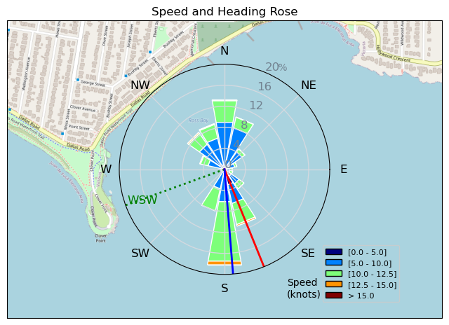
| Conditions | W 14-20, 2-3' |
| TOW | 2.0 hours |
| Toys | 187 lb / 85 kg Me Carbon-based Lifeform |
| HPS 1050 (1460cm2) Axis Foil | |
| 90cm Axis Alu Mast | |
| Crazy Short (60.0cm) Axis Black Advanced Fuselage | |
| 425 P Axis Rear Foil/Stab | |
| 5.5 Duotone Unit | |
| 75 lt Fanatic Sky Wing 5'0 | |
| Details | Arrived a tad early (3pm), so had to wait till about 4 for wind to finally make it around the point. Got to practice flying at max mast height at all times to avoid the lurking kelp, but that didn't stop the weed masses, eel grasses, sticks, logs, and lumber cuts from trying and often successfully sending me flying (negatively!) Still was a great time as the swell made up for it all with some really nice downwing surf. Big turnout, lots of new faces, winter is coming! Woohoo! [from Sailing Log on Saturday September 16, 2023] |
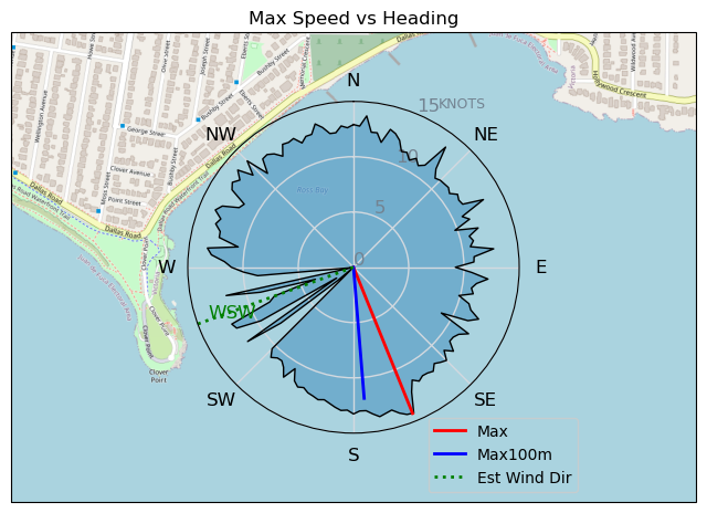
Speed (3s average)
| Speed | knots | km/h |
|---|---|---|
| Avg overall | 7.5 | 13.9 |
| Avg in motion | 9.3 | 17.2 |
| Max | 14.3 | 26.4 |
| Max 100m | 13.0 | 24.0 |
| Max 250m | 12.2 | 22.6 |
| Max 500m | 12.0 | 22.1 |
| Max 2s | 14.2 | 26.3 |
| Max 10s | 13.4 | 24.8 |
| Max Alpha (500/50m) | 10.8 | 19.9 |
| Avg Foiling | 9.6 | 17.8 |
Times and Duration
| Start | Sat Sep 16, 4:08 PM |
| End | Sat Sep 16, 6:02 PM |
| Duration | 01:54:17 |
| In motion | 01:32:31 |
| Paused (< 3 km/h) | 00:21:43 |
| Foiling | 01:25:07 |
| Not Foiling (< 8 km/h) | 00:29:07 |
| Last Calculated | Sun Sep 17, 10:14 AM |
Track Information
| Distance | 26.5 km |
| # Trackpoints | 5574 |
| Avg Trackpoint distance | 4.8 m |
| Number of Turns | 93 |
| Foiling Turns (> 8 km/h) | 78 |
| Foiling Turn Percentage | 84% |


Category: Wingfoiling
9 months ago

Created 9 months ago
UnusuallyLargeRobin |
Please register/login to download this track.
This track was downloaded 0 time(s). |
| 21 240521 Willows Beach |
| 31 Rainy Willows |
| 21 Pt.Holmes 05/21 |
| 29 240520 Ross Bay |
| 26 20240520 |
Please wait while loading suggestions..
Please wait while loading suggestions..
You must login to post comments.