RB - Wingfoil session #6
Bobson - Wingfoiling |
Sunday April 07, 2024 3:56 PM |
| Spot | Ross Bay |
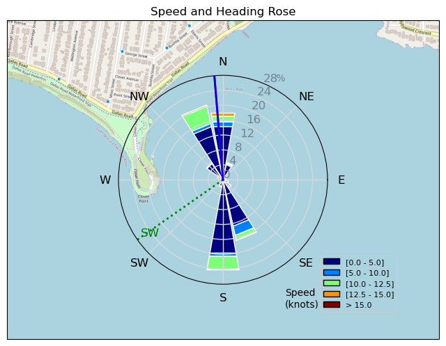
| Conditions | W 10-16, lumps past the point |
| TOW | 1.0 hours |
| Toys | 255 Starboard Stabilizer |
| 85cm Starboard Mast | |
| 1100 Starboard Evolution Foil | |
| 115 Starboard Evolution Fuse | |
| 6.2 Ensis Score | |
| 150 Starboard Freeride | |
| Details | Wing-sesh #6. Put in an hour on the Windfoil then it picked up to 15kts so came in and rigged the 6.2m Ensis Wing. Got some foiling runs in but no foiling actual foiling gybes but stayed dry the whole time so that was nice. Wind dropped off again so struggled getting on the foil without a huge amount of pumping. I figure I need a solid 13kts to get up and then maybe 10-12 to keep going. Some fun runs but as it's been lately not quite enough wind. Mon + Tues look like there will be some so hoping for some more Winging. BOBSON OUT!! [from Session Log on Sunday April 07, 2024] |
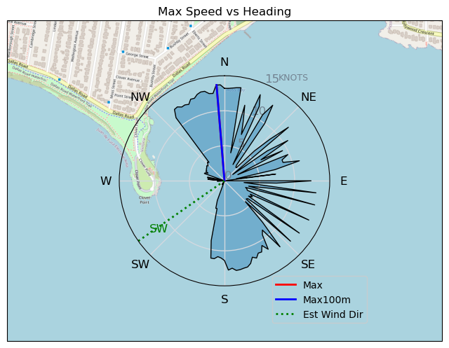
Speed (3s average)
| Speed | knots | km/h |
|---|---|---|
| Avg overall | 4.5 | 8.3 |
| Avg in motion | 4.6 | 8.6 |
| Max | 13.7 | 25.4 |
| Max 100m | 13.1 | 24.4 |
| Max 250m | 12.6 | 23.4 |
| Max 500m | 12.0 | 22.2 |
| Max 2s | 13.7 | 25.4 |
| Max 10s | 13.4 | 24.8 |
| Max Alpha (500/50m) | 7.3 | 13.5 |
| Avg Foiling | 9.3 | 17.3 |
Times and Duration
| Start | Sun Apr 07, 3:56 PM |
| End | Sun Apr 07, 5:01 PM |
| Duration | 01:04:35 |
| In motion | 01:02:11 |
| Paused (< 3 km/h) | 00:02:12 |
| Foiling | 00:15:22 |
| Not Foiling (< 8 km/h) | 00:49:01 |
| Longest Foiling Segment | 00:03:15 (1.1 km) |
| Last Calculated | Sun Apr 07, 6:46 PM |
Track Information
| Distance | 8.9 km |
| # Trackpoints | 3875 |
| Avg Trackpoint distance | 2.3 m |
| Number of Turns | 18 |
| Foiling Turns (> 8 km/h) | 0 |
| Foiling Turn Percentage | 0% |


Category: Wingfoiling
3 weeks ago

Created 3 weeks ago
Bobson |
Please register/login to download this track.
This track was downloaded 0 time(s). |
Please wait while loading suggestions..
Please wait while loading suggestions..
You must login to post comments.